Contact
 Comment faire ses achats
Livraison
Guide d'achat
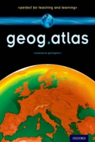
geog.atlas
 Anglais
 68 b
68 b
 common.delivery_to
Politique de retour sous 30 jours
Les clients ont également acheté

 /
Livre de poche
/
Livre de poche
 20.97
€
20.97
€


geog.atlas is an engaging atlas of accessible maps and supporting information. It features unique coverage of places likely to appear in the news, such as the Middle East, Afghanistan, and the Falklands. Special maps look at themes like global warming, desertification, and how people spread around the world. Stunning satellite images are placed alongside physical geography maps to aid understanding. A special section gives you up-to-date country data, while 'Did you know?' and 'What ifEL' circles provide interesting extra information and engaging facts. Full of clearly-labelled maps, straightforward explanations, and advice on how to 'read' maps and understand what they show, it will help improve students' basic locational knowledge, enhance their understanding, and build their confidence. geog.atlas supports teachers whether they're using geog.123 or an alternative course at KS3.
À propos du livre
Anglais
Catégories