 Contact
 How to shop
Delivery
Shopping guide
EifelSteig Pocket
 German
 30 b
30 b
 Delivery to Austria
30-day return policy
You might also be interested in


 /
Paperback
/
Paperback
 16.47
€
16.47
€


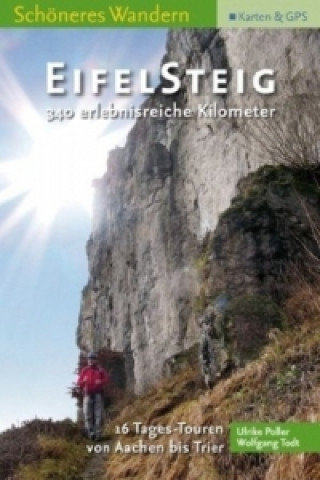
340 abenteuerliche Kilometer von Aachen bis Trier und neun Erlebnis-Rundrouten. Detaillierte Tourbeschreibung, offizielle Wanderkarte des LVermGeo mit endgültiger Trassenführung, GPS-Tour-Download, Höhenprofile, mehr als 250 Fotos, Einkehren und Übernachten. Komplett aufklappbar durch Otabind. §Stadt, Land, Fluss: 340 malerische Kilometer windet sich der neue Eifelsteig von Aachen nach Trier. Die Kombination aus Buch und Karte in wasserfester Hülle macht den Einstieg einfach. Auf Pilgerpfaden, durch einzigartige Naturschutzgebiete, wilde Schluchten und erloschene Vulkane führt der Weg, den die Wanderexperten Ulrike Poller und Wolfgang Todt detailliert beschreiben. 16 Tagesetappen enthalten alle notwendigen Hinweise für einen schönen Wandertag, neun zusätzliche Erlebnisschleifen erschließen die Landschaft links und rechts des Eifelsteiges für Rund- und Kombinationswanderungen. Das Buch enthält mehr als 250 Fotos, die Lust auf die Eifel machen - und verrät, was Wanderer neben der Strecke erwartet. Durch viele touristische Hinweise sowie Einkehr- und Übernachtunstipps ist das Start-Set eine wertvolle Hilfe zur Vorbereitung - und durch das kompakte Format ein leichgewichtiger Begleiter für unterwegs.
About the book
German
